Search
Geofumadas – GIS – CAD – BIM resources
Menú
Inicio
Blog
Cursos
Plantillas
{{ search }}
login/sign up
2007
Mapas en la web, quién será el ganador?
20
Dic
1
Posted in:
google Earth / maps
,
Read more
¿Se puede impresionar con un solo mapa?
19
Dic
3
Posted in:
ArcGIS-ESRI
,
AutoCAD-AutoDesk
,
Catastro
,
google Earth / maps
,
Manifold GIS
,
Microstation-Bentley
,
Tags:
ArcView
,
Bentley Systems
,
ESRI
,
Google Earth
,
Manifold GIS
,
Read more
Sistema de Aguas de Istanbul gana BE Award en categoría Geoespacial
19
Dic
2
Posted in:
geospatial - GIS
,
Microstation-Bentley
,
Tags:
Bentley Systems
,
ESRI
,
Read more
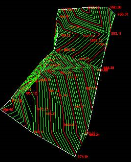
Construir curvas de nivel usando AutoCAD
19
Dic
16
Posted in:
AutoCAD-AutoDesk
,
Topografia
,
Tags:
Civil 3D
,
Read more
Mapas dinámicos con Visual Basic 9
18
Dic
Posted in:
Cartografia
,
geospatial - GIS
,
Tags:
ArcView
,
Read more
Precios especiales de ESRI para municipios
17
Dic
5
Posted in:
ArcGIS-ESRI
,
Microstation-Bentley
,
Tags:
Bentley Systems
,
ESRI
,
Read more
De Kml a Geodatabase
17
Dic
Posted in:
ArcGIS-ESRI
,
geospatial - GIS
,
Tags:
Google Earth
,
kml
,
Read more
Que busca ESRI con las nuevas licencias?
14
Dic
Posted in:
ArcGIS-ESRI
,
Tags:
ArcView
,
AutoDesk
,
Blog
,
ESRI
,
Read more
Geofumadas al vuelo Diciembre 2007
13
Dic
5
Posted in:
geospatial - GIS
,
Tags:
ArcView
,
Blog
,
gps
,
Mis Geofumadas
,
Read more
Problemas con la licencia de ArcGIS
13
Dic
75
Posted in:
ArcGIS-ESRI
,
Read more
Como aprender Microstation (y enseñar) de forma fácil
13
Dic
7
Posted in:
Enseñanza CAD/GIS
,
Microstation-Bentley
,
Tags:
Bentley Systems
,
Read more
Una forma fácil de enseñar (y aprender) AutoCAD
13
Dic
5
Posted in:
AutoCAD-AutoDesk
,
Enseñanza CAD/GIS
,
Read more
Descargas valiosas para usuarios SIG
13
Dic
Posted in:
ArcGIS-ESRI
,
geospatial - GIS
,
Tags:
ArcView
,
AutoDesk
,
ESRI
,
Grass
,
Read more
Scripts para cálculos complejos
11
Dic
Posted in:
geospatial - GIS
,
Tags:
Google Earth
,
Read more
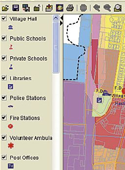
Georeferenciando un mapa de Googlemaps con Arcmap
10
Dic
15
Posted in:
ArcGIS-ESRI
,
google Earth / maps
,
Tags:
Manifold GIS
,
Read more
A propósito de Paperspace
09
Dic
Posted in:
AutoCAD-AutoDesk
,
Read more
Alternativas de Software SIG
09
Dic
3
Posted in:
CadCorp
,
geospatial - GIS
,
GvSIG
,
uDig
,
Tags:
AutoDesk
,
Bentley Systems
,
ESRI
,
Grass
,
gvSIG OS
,
Manifold GIS
,
Mapserver
,
QGIS
,
Read more
Conectarse a Digital Globe con Mapinfo, Autodesk map y Arcmap
07
Dic
1
Posted in:
ArcGIS-ESRI
,
AutoCAD-AutoDesk
,
geospatial - GIS
,
Tags:
AutoDesk
,
ESRI
,
Google Earth
,
Read more
1
2
3
…
5
Next
Sign In
The password must have a minimum of 8 characters of numbers and letters, contain at least 1 capital letter
I want to sign up as instructor
Recordarme
Sign In
Registro
Restaurar la contraseña
Send reset link
Password reset link sent
to your email
Cerrar
Your application is sent
We'll send you an email as soon as your application is approved.
Go to Profile
No account?
Registro
Sign In
Contraseña perdida