


AulaGEO les presenta este curso centrado en el desarrollo y la interacción de datos espaciales para la implementación de Internet....
OpenRoads Designer - Beginners civil works Level 1 - AulaGEO
Use CONNECT Edition - OpenRoads tool to Microstation civil design
Course details
Nivel
:
Bentley
Video
:
3 hours
Certificate of Completion
- Descripción
- FAQ
- Reseñas
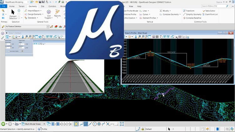
OpenRoads is the new combination of InRoads, GEOPAK and MX. In the Year in Infrastructure 2015 conference, Bentley Systems announced its OpenRoads CONNECT Edition software.
In this course we are going to go through basics of Bentley Open Roads Designer Connect Edition.
For this course, we will start with an introduction, over view, keyboard shortcuts and user interface / navigation in Bentley Open Roads Designer Connect Edition. We will try to go through all basics to get started.
We will try to cover up all basic commands to execute and edit horizontal geometries, vertical geometries, super elevations, corridors and terrains. We will also learn how to visualize different aspects of projects in different ways in order to get better conceptualization.
In later parts of this course, we will learn about civil cells which are preset templates in Bentley Open Roads Designer Connect Edition that become pretty handy when working on large scale projects.
Please be noted that there is no hard and fast rule to execute a specific command as there are multiple approaches to create similar output, however, we will try to follow the simplest approach possible to make this course easy and fun to learn for you.
#AulaGEO
Course content
GETTING STARTED
Bentley Open Roads vs Autodesk Civil 3D
Getting Started
Keyboard Shortcuts
HORIZONTAL GEOMETRY
Create Horizontal Geometry from Scratch
Read existing Horizontal Geometry
Edit existing Horizontal Geometry
Modify existing Horizontal Geometry
Annotate HorizontalGeometry
Vertical Geometry View and Horizontal Geometry Report Generation
VERTICAL GEOMETRY
Create Vertical Geometry
Edit Vertical Geometry using Table Editor
Edit Vertical Geometry using Dynamic Input (Right Click)
Vertical Geometry Report Generation
SUPER ELEVATION
Create Super elevation sections
Create Super elevation by road template
Super elevation rules and calculations
Super elevation view and edit
Super elevation report and CSV export
Super elevation table editor
CORRIDORS – the basics
Creating Corridor
3D View of Corridor
Template Drop
Cross Section View
Assign super elevation to corridor
TERRAIN – the basics
Read existing Terrain
Terrain Features
Editing Major and Minor Contours
Reference Terrain to 2D File
Editing Reference Terrain
Use of Element Templates
2D vs 3D Terrain View
Label Terrain Contours
Label Terrain Spot
Analyze Points
CIVIL CELLS
Civil Cell Placement
3D View of Civil Cell
Civil Cell Alternatives View
Edit Civil Cell Style
Edit Civil Cell Template
Edit Civil Cell Parameters
Edit Applied Surface Template
Parametric Constraints
Civil Cell Exercise
A Quick Virtual Tour
How long do I have access to the course materials?
You can view and review the lecture materials indefinitely, like an on-demand channel.
Can I take my courses with me wherever I go?
Definitely! If you have an internet connection, courses on Udemy are available on any device at any time. If you don't have an internet connection, some instructors also let their students download course lectures. That's up to the instructor though, so make sure you get on their good side!
Estrellas 5
42
Estrellas 4
40
Estrellas 3
21
Estrellas 2
0
Estrellas 1
4
THEORY
HORIZONTAL GEOMETRY
VERTICAL GEOMETRY
SUPER ELEVATION
CORRIDORS
TERRAIN
CIVIL CELLS
Final Project
Student questions - extra lessons

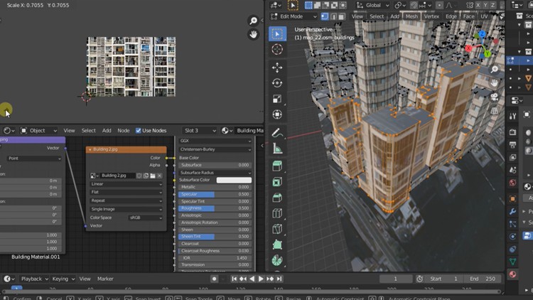
Blender 3D Con este curso los estudiantes aprenderán a utilizar todas las herramientas para modelar objetos en 3D, a través...

En este curso avanzado te muestro paso a paso como implementar la metodología BIM en proyectos y organizaciones. Incluyendo módulos...