
Guía completa del uso de Robot Structural Analysis para el modelado, cálculo y diseñó de estructuras de concreto y acero...
Remote Sensing Specialization - ArcGIS Pro & GEE - AulaGEO
Learn the fundamentals and applications of Remote Sensing, ArcGIS Pro and Google Earth Engine
Course details
Video
:
7 hours
Certificate of Completion
- Descripción
- FAQ
- Reseñas
LEVEL I – REMOTE SENSING FUNDAMENTALS AND APPLICATIONS
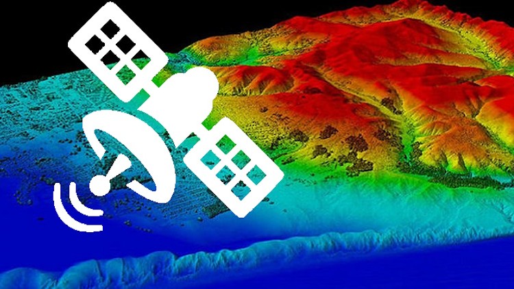
Remote sensing is the process of detecting and monitoring the physical characteristics of an area by measuring its reflected and emitted radiation at a distance (typically from satellite or aircraft). Special cameras collect remotely sensed images, which help researchers “sense” things about the Earth. Some examples are:
-
Cameras on satellites and airplanes take images of large areas on the Earth’s surface, allowing us to see much more than we can see when standing on the ground.
-
Sonar systems on ships can be used to create images of the ocean floor without needing to travel to the bottom of the ocean.
-
Cameras on satellites can be used to make images of temperature changes in the oceans.
Some specific uses of remotely sensed images of the Earth include:
-
Large forest fires can be mapped from space, allowing rangers to see a much larger area than from the ground.
-
Tracking clouds to help predict the weather watching erupting volcanoes, and help watching for dust storms.
-
Tracking the growth of a city and changes in farmland or forests over several years or decades.
-
Discovery and mapping of the rugged topography of the ocean floor (e.g., huge mountain ranges, deep canyons, and the “magnetic striping” on the ocean floor). #AulaGEO
LEVEL II – REMOTE SENSING USING ArcGIS Pro
This is a course on applications of Remote Sensing using ESRI Products. Includes: #AulaGEO
1) Introduction
i. Course Overview
2) Introduction to ArcGIS Online
i. Basics of ArcGIS Online
ii. ArcGIS Online Sign in and map viewer
iii. ArcGIS Online map layout and tools
iv. Preparing a map in ArcGIS Online
v. Introduction to ArcGIS Living Atlas
3) Introduction to ESRI Story Map
i. Basics of ArcGIS Story Map
ii. Overview of an example story map
iii. StoryMap layout (Part-A)
iv. Storymap layout (Part-B)
v. Final example of Story map
4) Land use science
i. Basics of Land use land cover (LULC) analysis
ii. Downloading satellite data from USGS
iii. Importing data and applying preprocessing inside ArcGIS Pro (Part-A)
iv. Importing data and applying preprocessing inside ArcGIS Pro (Part-B)
v. Performing land use classification (Part-A)
vi. Performing land use classification (Part-B)
vii. Visualizing and preparing final maps for LULC in ArcGIS Pro
5) Time series analysis for Urban Sprawl Analysis
i. Background of Time Series, Urban Sprawl, and Change Detection
ii. Preparing LULC maps for time series analysis
iii. Estimating the area for each LULC class for each year
iv. Change detection in ArcGIS Pro
v. Publishing findings for the study area using ESRI Story maps
6) Urban Heat Island (UHI) Effect
i. Basic concepts of UHI
ii. Evaluating LST from Landsat satellite in ArcGIS Pro (Part-A)
iii. Evaluating LST from Landsat satellite in ArcGIS Pro (Part-B)
iv. Evaluating UHI trends from LST
v. Evaluating UHI (Normalized) and UTFVI from LST
LEVEL III – INTRODUCTION TO GOOGLE EARTH ENGINE
Google Earth Engine is a platform for scientific analysis and visualization of geospatial datasets, for academic, non-profit, business, and government users. #AulaGEO
Google Earth Engine hosts satellite imagery and stores it in a public data archive that includes historical earth images going back more than forty years. The images, ingested on a daily basis, are then made available for global-scale data mining.
Earth Engine also provides APIs and other tools to enable the analysis of large datasets.
Google Earth enables you to travel, explore, and learn about the world by interacting with a virtual globe. You can view satellite imagery, maps, terrain, 3D buildings, and much more.
Earth Engine, on the other hand, is a tool for analyzing geospatial information. You can analyze forest and water coverage, land use change, or assess the health of agricultural fields, among many other possible analyses.
While the two tools rely on some of the same data, only some of Google Earth’s imagery and data are available for analysis in Earth Engine.
How long do I have access to the course materials?
You can view and review the lecture materials indefinitely, like an on-demand channel.
Can I take my courses with me wherever I go?
Definitely! If you have an internet connection, courses on Udemy are available on any device at any time. If you don't have an internet connection, some instructors also let their students download course lectures. That's up to the instructor though, so make sure you get on their good side!
Please, login to leave a review
LEVEL I - REMOTE SENSING BACKGROUND
LEVEL I - TYPES OF REMOTE SENSING
LEVEL I - APPLICATIONS OF REMOTE SENSING DATA
LEVEL II - REMOTE SENSING USING ArcGIS PRO
-
9
 Multispectral Satellite data
 -
10
Microwave (Radar) Satellite data
-
11
Hyperspectral Satellite data
-
12
Applications in Land Cover
-
13
Applications in Agriculture
-
14
Applications in Forestry
-
15
Applications in Geology
-
16
Applications in Hydrology
-
17
Applications in Sea-ice
-
18
Applications in Oceans and Coastal
LEVEL II - INTRODUCTION TO ArcGIS ONLINE
LEVEL II - INTRODUCTION TO ESRI STORY MAP
LEVEL II - LAND USE SCIENCE
LEVEL II - TIME SERIES ANALYSIS FOR URBAN SPRAWL ANALYSIS
-
30
Basics of Land use land cover (LULC) analysis
-
31
Downloading satellite data from USGS
-
32
Importing data and applying preprocessing inside ArcGIS Pro (Part-A)
-
33
Importing data and applying preprocessing inside ArcGIS Pro
-
34
Performing land use classification (Part-A)
-
35
Performing land use classification (Part-B)
-
36
Visualizing and preparing final maps for LULC in ArcGIS Pro
LEVEL II - URBAN HEAT ISLAND (UHI) EFFECT
LEVEL III - INTRODUCTION TO GOOGLE EARTH ENGINE (GEE)
LEVEL III - BASICS OF GOOGLE EARTH ORIENTED JAVSCRIPT (JS) PROGRAMMING LANGUAGE
LEVEL III - WORKING WITH VECTOR AND RASTER DATASETS - GOOGLE EARTH ENGINE
LEVEL III - THE ROLE OF REDUCERS - GOOGLE EARTH ENGINE
LEVEL III - AUTOMATING THE ANALYSIS IN GEE


Alineamientos avanzados, superficies, secciones transversales. Aprende a crear diseños y obras lineales básicas con el software Autocad Civil3D aplicado a...

Guía práctica de diseño con Modela de Información de Edificios dirigido al diseño estructural. Dibuja, diseña y documenta tus...